Environmental Technology Lab
Field sites
Our main research areas are the 24 sites of FutureScapes, the Centre of Excellence for Sustainable Land Use, which include wetlands (Lavassaare, Tellissaare, Laiuse, Selgise/Alajõe), grasslands (Saastna nina, Penijõe, Laelatu, Uusküla, Pikknurme, Mälgi), forests (Rumba, Nõmmküla, Kanaküla, Koljaku, Välgi, Selgise), and agricultural land (Haljala, Sadala, Kämara, Vana-Kuuste, Andre Farm). In addition, we also have research sites in Lavassaare, Rumba, Ess-soo and Vända.

Lavassaare extracted peat fields
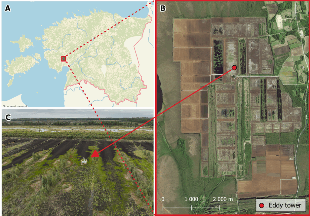
There are vast extracted peatlands in western part of Estonia. Most of them are near Lavassaare settlement (807 ha). They are currently drained and have almost no vegetation cover and represent a huge carbon emitter. This site has great potential for integrated wetland restoration and green energy development (wind and/or solar). Nearby, currently active peat extraction sites (>5000 ha) offer clear upscaling potential for the future.
Lavassaare areas have been selected for restoration. Rewetting will restore long-term carbon sinks and will prevent further oxidative emissions. Our workgroup aim is to measure greenhouse gases in two sample areas. Eddy covariance measurements will start in one of those areas (N 58.562, E 24.370) with no vegetation in summer 2022, equipped with LI-7700 Open Path CH4 Analyzer and LI-7500DS Open Path CO2/H2O Analyzer. Second area have vegetation coverage and measurements are planned to start in end of 2022. Results will hopefully show that after restoration, peatland starts to accumulate carbon again.
Rumba drainage ditch reconstruction works site
State Forest Management Centre is planning to build sediment basins and small fens in managed forest site located in Rumba village, Pärnu county (N 58.718135, E 24.127875). We are collecting water samples from ditches before entering sediment basin/fen to analyze water chemistry parameters.
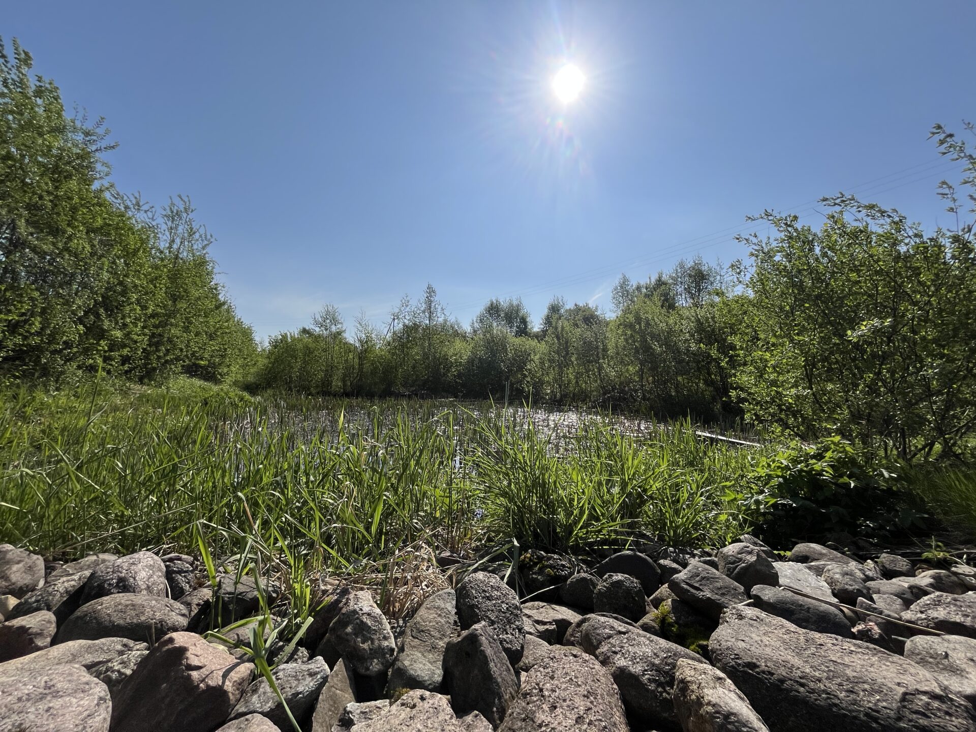
Ess-soo bog
Vända constructed wetland
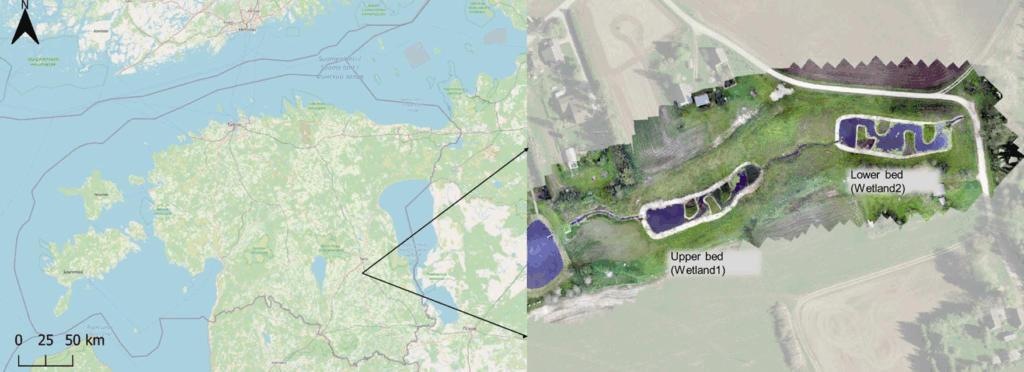
Vända constructed wetland (CW), located ca 12 km south of Tartu (58°16’57” N 26°43’19″E), was established in 2015 with support of Estonian Fund for Nature and World Wildlife Fund. Its goal is to reduce agricultural pollution from agricultural lands. Also, to study parameters that affect nutrient reduction and greenhouse gas emissions (Estonian Fund for Nature). CW consists of upper and lower ponds with total 2.2 km2. Upper pond was planted with cattail (Typha latifolia) and common reed (Phragmites australis), while lower pond was left to be vegetated naturally. Water samples collected in 2017 – 2021 showed that nutrient removal efficiency and greenhouse gas emissions depend highly on water parameters and wetland design. Vända CW can effectively reduce phosphorus. However, due to nitrate-contaminated groundwater, CW it acts more as source of nitrogen. After the second study year, the TN removal efficiency was over 15.0% and that of NO3-N to over 11.7% in the lower pond. The annual removal efficiency in the first study year was 11.7±4.8% for TP and 12.6±5.7% for PO4-P, which increased to 46.0±6.2% and 33.0±6.6%, respectively, for the fourth study year (Kill, K. 2022).